INTRODUCTION
Land is one of the most important assets for a farmer. Every decision related to agriculture—whether it’s about taking a loan, selling a portion of land, or applying for government schemes—depends on accurate land records. In Karnataka, the government has taken a huge step to empower farmers by launching the Dishank App, which simplifies access to land information using GPS technology.
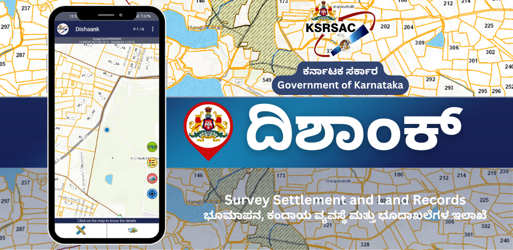
The Dishank App (Digital Survey of Karnataka) is developed by the Karnataka State Remote Sensing Applications Centre (KSRSAC). It allows users to instantly retrieve land survey numbers and view revenue maps by using their mobile phones. In this article, we’ll explore how the Dishank app works, its features, and why it is becoming an essential tool for farmers.
—
The Importance of Land Records for Farmers
For decades, landowners and farmers in Karnataka faced challenges when trying to access land-related information. Paper-based records, long delays at government offices, and a lack of transparency made it difficult for farmers to know accurate details about their land.
Key problems included:
Not knowing the correct survey number.
Boundary disputes with neighbors.
Trouble verifying land before buying or selling.
Missing out on government benefits due to incorrect land documents.
To solve these problems and digitize the land management system, the Karnataka government introduced the Dishank app, which makes land records easily accessible with just a smartphone and GPS.
—
What is the Dishank App?
Dishank is a mobile application that uses Global Positioning System (GPS) and GIS mapping to help citizens identify land survey numbers and view land boundaries on official government maps. It is designed to reduce dependence on intermediaries and make land data available at the fingertips of every landowner, especially farmers in rural areas.
It is currently available for Android phones and can be downloaded from the Google Play Store.
—
Key Features of the Dishank App
Here are the main features that make Dishank a powerful and useful app:
1. GPS-Based Survey Number Identification
By simply standing on their land and opening the app, users can see the survey number of the plot they are on. This is helpful for farmers who don’t know the survey number of their land or who want to check if someone is encroaching on their property.
2. Access to RTC (Pahani)
Farmers can view the Record of Rights, Tenancy and Crops (RTC), also known as Pahani, directly from the app. This document contains important information like the landowner’s name, area of land, type of cultivation, and tenancy details.
3. View Revenue Maps
Dishank provides access to digitized village maps, allowing users to view survey boundaries, roads, tanks, and adjacent lands. These maps are useful in resolving boundary disputes and planning agricultural activities.
4. Multilingual Interface
The app is available in both Kannada and English, making it accessible to a wide range of users, especially Kannada-speaking farmers.
5. Simple and Free to Use
Dishank does not require complex sign-ups or fees. It is free to download and use, with a clean interface designed for all age groups.
—
How Farmers Benefit from the Dishank App
The Dishank App is specifically designed to make land information transparent and accessible. Here are some of the direct benefits for farmers:
✅ 1. Saves Time and Money
Earlier, farmers had to visit revenue offices and depend on middlemen to get land details. With Dishank, they can find everything on their phone without paying extra fees or waiting in lines.
✅ 2. Helps in Selling and Buying Land
Before buying land, a farmer or buyer can use Dishank to check whether the seller’s information is genuine. This reduces the chances of fraudulent land sales.
✅ 3. Reduces Boundary Disputes
Since the app shows official survey maps, farmers can use them to resolve disputes with neighbors or family members about land ownership or borders.
✅ 4. Assists with Government Schemes
Many schemes like PM-KISAN, crop insurance, and subsidies require land ownership documents. Dishank helps farmers easily access these documents when needed.
✅ 5. Accurate Disaster Assessment
During floods or droughts, government officials use Dishank to assess which lands are affected. This ensures fair compensation and relief distribution to farmers.
—
How to Use the Dishank App – Step by Step
Using the Dishank app is easy and quick. Here’s how:
1. Go to the Google Play Store and search for Dishank Karnataka.
2. Download and install the app developed by KSRSAC.
3. Open the app and allow location access (GPS).
4. Stand on the land you want to check.
5. The app will show the survey number and let you view land maps and RTC details.
You can also manually search for survey numbers by selecting the district, taluk, hobli, and village.
Real-World Example
A farmer in Mandya district had been facing a land dispute with a neighbor over the boundary of their field. With the help of the Dishank app, the farmer was able to show the official boundary as per the government’s map. This resolved the conflict without needing to go through a long legal process.
In another case, a young farmer in Gadag used the app to confirm land details before buying a new agricultural plot. He verified the survey number and RTC, ensuring the deal was legal and clean.
—
Limitations and Areas for Improvement
While Dishank is a great initiative, it still has a few limitations:
No iOS App: Currently, it is only available on Android.
Requires Internet: Users in areas with poor connectivity may face difficulties.
Lack of Awareness: Many farmers are still unaware of the app or don’t know how to use smartphones effectively.
These issues can be resolved through government outreach programs, mobile training camps, and rural internet infrastructure.
—
Government’s Vision Behind Dishank
The goal of Dishank is not just to help with land data, but also to promote e-governance, reduce corruption, and digitize rural services. It aligns with the Digital India Mission and the Bhoomi Land Records project.
By integrating with other government platforms like Kaveri Online and Bhoomi RTC, Dishank is creating a seamless land management ecosystem for Karnataka’s farmers.

Conclusion
The Dishank App is truly a digital revolution for Karnataka’s farmers. It has made access to land records, revenue maps, and survey details easier than ever before. With just a mobile phone and an internet connection, farmers can now handle their land affairs independently and with full confidence.
As more farmers adopt this technology, the days of standing in long queues at revenue offices and relying on agents will soon be a thing of the past. Dishank is a step toward empowerment, transparency, and self-reliance in rural Karnataka.
—