Track Land Details Using GPS and Online Tools (2025 Guide)
In 2025, tracking and verifying your land using GPS technology and digital portals has become easier and more reliable across India. Whether you’re a farmer, land investor, property buyer, or landowner, knowing how to use GPS apps and government land record portals is essential. This comprehensive guide explains the best GPS apps, how to check land ownership with survey numbers, and how to access legal land records online.
Why Land GPS and Digital Land Records Matter
Digital land mapping helps reduce disputes, fraud, and encroachments. With GPS-based apps and government e-portals, landowners can:
- Accurately track land boundaries
- Check survey numbers and land ownership
- Access pahani, RTC, and mutation records
- Measure land area for agriculture or legal purposes
- View encroachment alerts and revenue maps
This digital transformation supports transparency, improves revenue collection, and empowers farmers and landowners.
Best Land GPS Tracking Apps in India (2025)
1. Dishank App (Survey of India)
- Use: View your land location and verify government survey maps.
- Available for: Karnataka
- Features:
- Overlay survey numbers on satellite maps
- Match physical land boundaries with official records
- Shows nearby landmarks, road connectivity
- Download: Available on Google Play Store
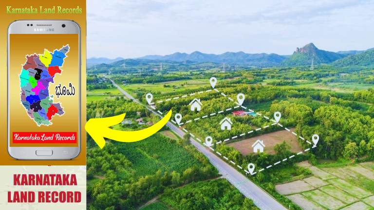
2. Karnataka Bhoomi Online (Mobile version)
- Use: Access RTC, Mutation Status, and Tippan
- Website: landrecords.karnataka.gov.in
- Data Available: RTC, pahani, mutation register, ownership history
3. mPariksha (Maharashtra)
- Helps view 7/12 extract and land boundary through GPS.
- Government-integrated data with satellite mapping.
4. GeoMeasure App
- For private use across India to measure land area using GPS.
- Works offline and includes unit conversion tools (acres, hectares).
5. Khasra Khatauni App (UP & MP)
- Region-specific app to access land records and ownership details using GPS.
- Supports English and local languages.
How to Check Land Ownership Using Survey Number
You can verify land ownership using survey number and GPS location by following these steps:
Step 1: Visit the official state land record website
Each state has its own portal (see below). Select the district, taluk, and village.
Step 2: Enter Survey Number
Input the correct survey number, Hissa number, and other details.
Step 3: View Records
You’ll see the following details:
- Owner’s name
- Land area (acres/guntas/hectares)
- Type of land (wet/dry/agricultural/commercial)
- Occupancy status
- Mutation history
Step 4: Download or Print RTC / Pahani / 7/12
You can use the records for bank loans, legal proof, and verification.
State-Wise Land Record Websites (India)
| State | Land Record Portal URL |
|---|---|
| Karnataka | landrecords.karnataka.gov.in |
| Maharashtra | bhulekh.mahabhumi.gov.in |
| Uttar Pradesh | upbhulekh.gov.in |
| Madhya Pradesh | mpbhulekh.gov.in |
| Telangana | dharani.telangana.gov.in |
| Andhra Pradesh | meebhoomi.ap.gov.in |
| Tamil Nadu | eservices.tn.gov.in |
| Bihar | biharbhumi.bihar.gov.in |
You can find full ownership details, mutation status, RTC, and FMB maps here.
Benefits of Land GPS and Online Mapping
1. Avoid Land Encroachments
You can compare GPS data with official maps to detect unauthorized occupation.
2. Support for Legal Disputes
Digitally verified records are admissible in court, strengthening your legal claim.
3. Eligibility for Government Schemes
Subsidy schemes for farmers like:
- PM-Kisan
- Kisan Credit Card (KCC)
- Drip/Sprinkler Subsidy
require valid land ownership proof.
4. Digital Land Transactions
Buyers and sellers can now verify land before making deals, reducing fraud.
How GPS Helps in Agricultural Planning
Land GPS apps are also useful for:
- Crop planning using land measurement tools
- Fencing layout and design
- Farm pond location marking
- Irrigation planning with slope and topography information
Some advanced GPS tools integrate with drones, satellite maps, and weather alerts.
Satellite Imagery and Bhuvan Portal (ISRO)
You can also use the Bhuvan portal by ISRO to:
- View satellite-based land data
- Check land use and crop coverage
- Access geospatial data at national and regional levels
Visit: bhuvan.nrsc.gov.in
Key Documents Required for Land Ownership Verification
- Survey number or RTC copy
- Aadhaar number (for linking records)
- Mutation extract (if land recently transferred)
- Mobile number (for OTP verification)
Farmers and Landowners – What You Must Know
- Always keep a copy of RTC/Pahani/7/12 documents.
- Update land records if there is any sale, inheritance, or gift.
- Ensure your name is registered on the mutation register.
- Use GPS and FMB maps to check accuracy on the ground.
Common Issues and How to Fix Them
| Issue | Solution |
|---|---|
| Owner name not updated | File mutation request online or at taluk office |
| Survey number mismatch | Request for resurvey or file complaint at revenue office |
| GPS not matching with map | Get FMB map from Bhoomi portal and verify with Tahsildar |
| Land not visible online | Contact village accountant or upload property details via citizen portal |
Frequently Asked Questions (FAQ)
1. Is GPS-based land tracking accurate?
Yes, most apps provide 95–98% accurate mapping when used in open fields with good signal.
2. Can I check land records on my phone?
Yes, apps like Dishank, Bhoomi mobile app, and mPariksha are designed for mobile users.
3. What is the cost to access GPS mapping?
Government portals are free. Private GPS apps may charge for advanced features.
4. Can landowners apply for farm subsidy using GPS proof?
Yes, some schemes accept GPS-marked land measurement reports as supplementary proof.
Technology has made land ownership tracking simpler than ever before. By using GPS apps and online portals, farmers and landowners in India can take control of their property data and protect their legal rights. Whether you’re applying for subsidies or avoiding land fraud, digital tools are the key.
Keep your records updated, use reliable apps, and always verify survey numbers with GPS data. The future of land ownership is digital – make sure you’re ready.